Bicycling along the Mohawk Towpath Byway, a National Scenic Byway
View Mohawk Towpath Byway in a larger map Click to refresh the map
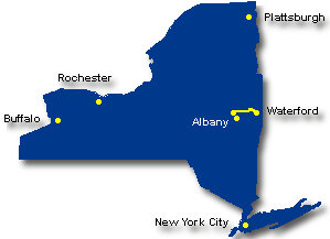
The Mohawk Towpath Byway is a network of local, county, state and federal highways that follow the historic route of the Erie Canal from Waterford and Cohoes to the historic Stockade District of Schenectady. Communities along the way include Cohoes, Halfmoon, Colonie, Crescent, Vischer Ferry and Rexford. The route tells the story of the Erie Canal and the role these historic communities played in the Industrial Revolution and in the westward expansion of the country. Diverse wildlife habitats, classic architecture and beautiful vistas are sprinkled throughout the corridor.
See the Mohawk Towpath Byway website for all the details about this National Scenic Byway, one of only three in the region.
Road Bike Opportunities
One of the best ways to experience the Mohawk Towpath Byway is by bicycle.
Here are two great suggestions:
- Rexford Ramble Historic Bike Tour, Vischer Ferry and Rexford – Cyclists follow a 15-mile self-guided tour of historic western Clifton Park that locals call the Rexford Ramble. Starting and finishing at the Vischer Ferry Fire House, this ride was designed for a National Trails Day celebration in Clifton Park and is best enjoyed on a weekend morning or mid-morning on a week day, when traffic is light. Download the map and narrative of this and other rides from the website of the Mohawk Towpath Byway.
- Bike the Mohawk Towpath Byway – Circumnavigate this part of the Mohawk River and Erie Canal with this 36-mile bike tour of the Mohawk Towpath Scenic Byway, a great way to enjoy many of the historic and recreational features within the Byway’s corridor. Suggested starting spots are on the Mohawk-Hudson Bikeway at either the Colonie Mohawk River Park or Niskayuna Lions Park. also see a map of the Byway
Family Bike Rides
There are quite a number of paved or stone-dust bike paths in the vicinity of the Mohawk Towpath Scenic Byway. Most of the stone-dust pathways are associated with the Champlain Canal Cooridor, a potential 62-mile historic towpath connecting the Mohawk River at Waterford to Lake Champlain at Whitehall. A number of sections are in place and more are planned.
The main paved path near the Scenic Byway is the Mohawk-Hudson Bikeway running along the south side of the Mohawk River and down the Hudson River to the Albany waterfront.
Cycling Along the Canals of New York State (Rossi) is a great guide to this and other canal areas in NY. Some of the great family and cruising rides in the area include the following:
- Mohawk-Hudson Bike-Hike Trail – This 40-mile paved path is almost continuous except for a few gaps where the route is on-road. The west end of the pathway is in Pattersonville west of Albany and it follows the Mohawk River east to where it meets the Hudson River, then follows the Hudson south between the river and the city of Albany, to Erastus Corning Riverfront Preserve. also see Schenectady County
- Zim Smith Trail, Malta – Stretching 6 miles south from the Town of Malta to the City of Mechanicville along the old D&H railroad bed. From the north, the trail crosses under the Northway and then crosses over Rte 9. From there it runs through the wetland area southwest of Round Lake. Most of the trail is asphalt with some hard packed dirt sections. also see this description & map
- Old Champlain Canal, Waterford – A 3-mile-long dirt path along the Old Champlain Canal in Waterford. The trail starts near the Mohawk River and extends past Route 32 to Old Lock 5. The trail has been extended north for several miles north of Broad Street.
- Champlain Canalway Trail, Halfmoon – A 2-mile section of stone-dust trail along the Old Champlain Canal in the Town of Halfmoon. Trailhead parking is available at the northern end. The town has plans to improve the entire six miles of trail within Halfmoon. also see this description & map
- Cresent Trail-Erie Canal Trail, Halfmoon – There are about 2.5 miles of dirt path along the north bank of the Mohawk River in the Crescent Park area of Halfmoon. It starts right near the Route 9 bridge crossing where there is a small parking area near the junction of Vischer Ferry Road and Old Canal Road. It heads west from there and the Town has plans to add another 2.5 miles that will pass under the Twin Bridges and meet up with a section of path in Clifton Park.
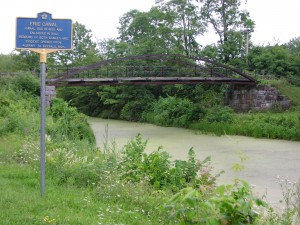
- Vischer Ferry Nature and Historic Preserve – This 600-acre preserve is popular for mountain biking as well as walking. The preserve encompasses the area between Riverview Road and the Mohawk River in the Town of Clifton Park. The progress of Erie Canal development can be seen in this one location, with a segment of the original 1825 Erie Canal and towpath, a segment and a number of structures from the 1842 enlarged Erie Canal, and the currently used NY State Barge Canal. The entrance to the preserve includes a restored 1862 Whipple Truss Bridge, a design used widely to bridge the canal during the latter half of the 19th century, and one of only a few in existence.
Not to Miss
- Waterford Harbor Visitor Center – Views and interpretive history where the Hudson, Mohawk and Erie Canal meet, just before the bridge to Peebles Island.
- Peebles Island State Park – One of five islands at the confluence of the Mohawk and Hudson Rivers, it was the site of a Revolutionary War battle and an industrial site during part of the 18th and the entire 19th century. An extensive nature trail network is open year-round. Facilities include the state park’s collection of historic materials and the Erie Canalway Heritage Corridor Visitors Center.
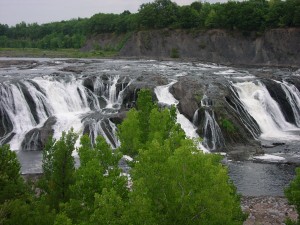
- Cohoes Falls on the Mohawk River – One of the key scenic assets along the Mohawk Towpath Byway. In 2008, the ability to view its stunning natural beauty improved considerably with the opening of Falls View Park. The park serves as a historical link between the falls and Cohoes’ historic Harmony Mills district. A footbridge now crosses a power canal, a successor to the original 1825 Erie Canal. Across North Mohawk Street is the remaining stone work of Lock 18, the upper feature of a series of 16 locks that raised boat traffic around the 75-foot falls. Signage at the park highlights the historical, educational and geological significance of Cohoes Falls, the Mohawk River and other nearby points of interest.
- Harmony Mills Historic District – An important monument to the industrial and social growth of the Albany area – the characteristic red brick structures were once the largest textile manufacturing complex in the nation. Located on the Mohawk River near the Erie Canal and Cohoes Falls.
- Historic Grooms Tavern – The 180-year-old structure has been home to a general store, a stop-over place along major regional transportation arteries, a tavern and a public meeting place. It is now a historical and community center.
also see Mohawk Towpath Byway for many more points of interest along this route.
Bike Events in the Area
- Bike the Byway, Colonie, 2nd Saturday in August – A casual, 36-mile ride with historic interpretation at the refreshment stops along the way. 9AM start at the entrance to Colonie Town Park on Schermerhorn Road (in 2011). Points of interest include river valley vistas, the confluence of the Mohawk and Hudson rivers, 19th-century Erie and Champlain Canal features, current-day canal facilities, Falls View Park in Cohoes, and Waterford’s harbor area. Ride shirt will be available for a donation of $20 or more to the Mohawk Towpath Scenic Byway Coalition.
- Mohawk Towpath Byway Duathlon – Crescent and Vischer Ferry, the 3rd Sunday in October, when the foliage is at its peak. The 2.2-mile run, 16-mile bike, and another 2.2-mile run to the finish is a popular event along the Mohawk River and raises funds for the Mohawk Towpath Byway.
also see the complete list of bike events in the region
Bike Shops Nearby
- Adirondack Bicycles, Scotia
- CK Cycles, Albany
- Down Tube Cyclery, Albany
- Elevate Cycles II, Clifton Park
- Freeman’s Bridge Sports, Scotia
- Plaine & Son, Schnectady
also see the complete list of bike shops in the region
Visitor Information
- Adirondack Regional Chamber of Commerce
- Adirondack Regional Tourism Council
- Albany County Convention and Visitors Bureau
- Saratoga County Tourism Information
- Warren County, Lake George Tourism Information
- Washington County Tourism Information
also see the complete list of visitor information resources for the region
Check in with Chamber offices, bike shops and other sports shops in the area to get the latest information and review your route with someone knowledgeable of the area. When biking, dress for the weather and carry water, snacks, map, repair kit and cell phone. When biking in rural areas, services could be few and far between, and cell phone service may not always be available. See the Before You Ride notices in the bottom section of this website, as well as the Disclaimer notice.
Below are some of the sights along the way. Scroll over an image to see its title, or click an image to enlarge it and then move through the entire gallery (from the gallery, click on one of the large image to return here).
| Warren County Bikeway | Glens Falls | Lake George Village |


