Forestport-Rome Bicycling along the Central Adirondack Trail
View Forestport-Rome along the Central Adirondack Trail in a larger map Click to refresh the map
![]() The 28 miles along the Forestport-Rome segment of the Central Adirondack Trail is a ride back in history to 1817 when construction of the Erie Canal began in Rome NY, to 1776 when Fort Stanwix was reconstructed by the patriots, to the French and Indian War of 1750s, and back through the centuries when Native Americans used these same rivers and portages for transportation and trade.
The 28 miles along the Forestport-Rome segment of the Central Adirondack Trail is a ride back in history to 1817 when construction of the Erie Canal began in Rome NY, to 1776 when Fort Stanwix was reconstructed by the patriots, to the French and Indian War of 1750s, and back through the centuries when Native Americans used these same rivers and portages for transportation and trade.
The route to Rome follows Cincinnati Creek for a ways, through East Steuben and Remsen. Route 12, on the Scenic Byway, is the most direct route to Barneveld where the Byway turns west on Route 365 toward Rome. While Route 12 has wide shoulders, it is a large divided highway with heavy traffic. An alternate route – County Route 82 – parallels Rt 12 starting at East Steubens and passes through Remsen. There are a number of alternate routes from Remsen to Barneveld, Holland Patent and on into Rome.
There are a number of mountain bike trails north of Rome toward Boonville, with a number of them maintained by BREIA for both biking and cross-country skiing. The BREIA website provides maps for the 7-mile Boonville Black River Canal Trail leading from Boonville to Pixley Falls State Park. There is also the Black River Feeder Canal Trail, a stone-dust trail connecting Boonville and Forestport. See the Bike Atlas Maps developed by the Herkimer-Oneida Counties Transportation Study.
Road Bike Opportunities
On-road or path rides and loops in the area include:
- Family Ride – The Rome-Oriskany 6-mile trail segment that travels near the Oriskany Battlefield State Historic Site and through the Oriskany Flats State Wildlife Management Area. Parking is available at the intersection of Routes 69 and 365 and on River Street between Routes 49 and 69. See the pdf listing Bicycling Paths and Multi-Use Trails provided by Herkimer and Oneida counties.
- Moderate Ride – The Syracuse-Rome 36-mile trail segment along the Old Erie Canal towpath, traveling through the Old Erie Canal State Park between State Bridge and Rome. There are on-road links using Canal Street between Durhamville and State Bridge and Lock Road in the vicinity of Lock 21 near Stacy Basin. Parking is available at a rest area east of State Bridge on Rt 46, at Lock 21 and at the Erie Canal Village on Rome-New London Road (Rt 46). Use caution and walk your bike carefully when traversing the downstream gate at Lock 21. See the listing Bicycling Paths and Multi-Use Trails provided by Herkimer and Oneida counties; also see Cycling Along The Canals of New York State by Louis Rossi.
- Training Rides – Rome to Sylvan Beach, a 40-mile round-trip ride mostly along lightly traveled roads, with Verona Beach State Park as the refreshing destination. Another version of the ride can be done as a 45-mile loop through Oneida. A 76-mile loop from Rome follows the south shore of Oneida Lake and takes in Bridgeport, Manlius, Chittenango and Canastota. NYS Bike Route 5 & 69 passes through Rome on its route across the state from Niagara Falls to Albany.
Mountain Bike Opportunities
Mountain biking opportunities along this segment of the Central Adirondack Trail vary from the more challenging single track in the Tug Hill area around Boonville, to the rolling stone dust and grass towpath trails near Forestport, Pixley Falls State Park and south of Rome along the Old Erie Canal.
Always check in with the bike shops and Chambers of Commerce to get a handle on current conditions and how to find the best rides for your group.
- BREIA Trail System – Near Boonville and Alder Creek, the Black River Environmental Improvement Association (BREIA) offers more than 50 kilometers of trails in three diverse landscapes, each providing a distinctive biking experience. Promoted mainly as cross-country ski trails, mountain biking is permitted on most trail sections, with a few exceptions. Maps for each system are available at the trailheads.
- Boonville-Pixley Falls Black River Canal Trail – A seven-mile rolling grass trail connecting Boonville and beautiful Pixley Falls State Park, part of the BREIA Trail System. Maps available from BREIA and from the Herkimer-Oneida Bicycle Atlas.
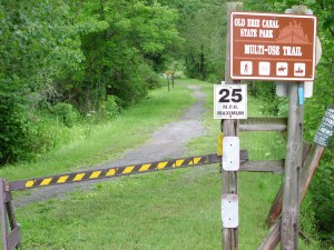
- Old Erie Canal State Park – a 36-mile stretch of the 363-mile Old Erie Canal with a terminus in Rome. Designated a National Recreational Trail by the National Parks Service, the terrain is woodland and wetland, offering pleasant biking opportunities for families on a short ride or for distance riders that want a reprieve from highway riding. Historic sites include remnants of stone aqueducts. see more info on Erie Canal State Historic Park
Not to Miss
- Black River Canal Museum – Boonville
- Black River Canal trails and other mountain biking opportunities in the Boonville area
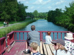
- The horse-drawn canal boat ride at Erie Canal Village
- A tour of Fort Stanwix
- The significance of Oriskany at the Oriskany Battlefield State Historic Site
also see Adirondack Scenic Byways.org for many more points of interest along this route
Bike Events in the Area
- Erie Canal Bike Tour, Buffalo to Schenectady, 2nd week of July
also see the complete list of bike events for the region
Bike Shops Nearby
- Pedals & Petals, Inlet
- Mountain Man Outdoor Supply Company, Old Forge
- Mike’s Cycle & Sport in Lee, NW of Rome
also see the complete list of bike shops for the region
Visitor Information
- Adirondack Regional Tourism Council
- Boonville Area Information
- Central Adirondack Trail Scenic Byway
- Herkimer County Tourism Information
- Inlet Area Information
- Old Forge Area Information
- Oneida County Tourism Information
- Rome Area Information
also see the complete list of visitor information resources for the region
Check in with Chamber offices, bike shops and other sports shops in the area to get the latest information and review your route with someone knowledgeable of the area. When biking, dress for the weather and carry water, snacks, map, repair kit and cell phone. When biking in rural areas, services could be few and far between, and cell phone service may not always be available. See the Before You Ride notices in the bottom section of this website, as well as the Disclaimer notice.
Below are some of the sights along the way – scroll over an image to see its title, or click an image to enlarge it and then move through the entire gallery (click on one of the large images to return here).
| Warren County Bikeway | Glens Falls | Lake George Village |


